Weather can make or break your time on the water, whether you’re cruising, fishing, or simply enjoying a day offshore. With TZ Weather, you gain access to powerful, easy-to-interpret animated weather layers that help you plan smarter, navigate safer, and fish more effectively. Designed specifically for mariners, both the FREE and Premium TZ Weather services offer precise data visualization on your NavNet TZtouchXL display, making it simple to anticipate changing conditions and make informed decisions in real time.
It's simple to subscribe to TZ Weather directly from your MFD.
With TZ Weather, you're not just seeing the forecast. You’re understanding it at a glance. Every layer is engineered to be intuitive, actionable, and beautifully displayed, giving you the tools to make smarter decisions every time you leave the dock.
Find Fishing Hot Spots
Beyond planning your trips and staying ahead of the weather, NavNet TZtouchXL's FREE TZ Weather helps you determine the best areas to catch fish based on current, waves, and wind. Part of the update with software version 25, TZ Weather gives you a ton of free weather data that can be easily downloaded onto your TZTXL MFD. Premium weather is also available with a $8.99/month subscription. Take a moment to visit with Capt. Mike Genoun of Florida Sport Fishing TV as he walks you through how he uses TZ Weather to get on the bite.
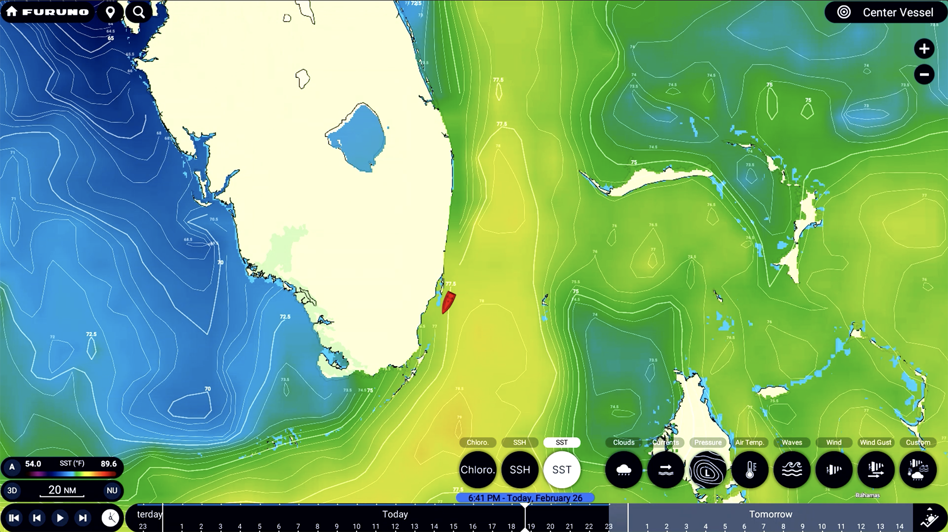
Sea Surface Temperature (SST)
Understanding water temperature is critical for fishing and route planning. TZ Weather's SST overlay highlights subtle changes in surface temperature, helping anglers target specific species and enabling cruisers to locate currents or thermal boundaries that affect comfort and fuel efficiency.
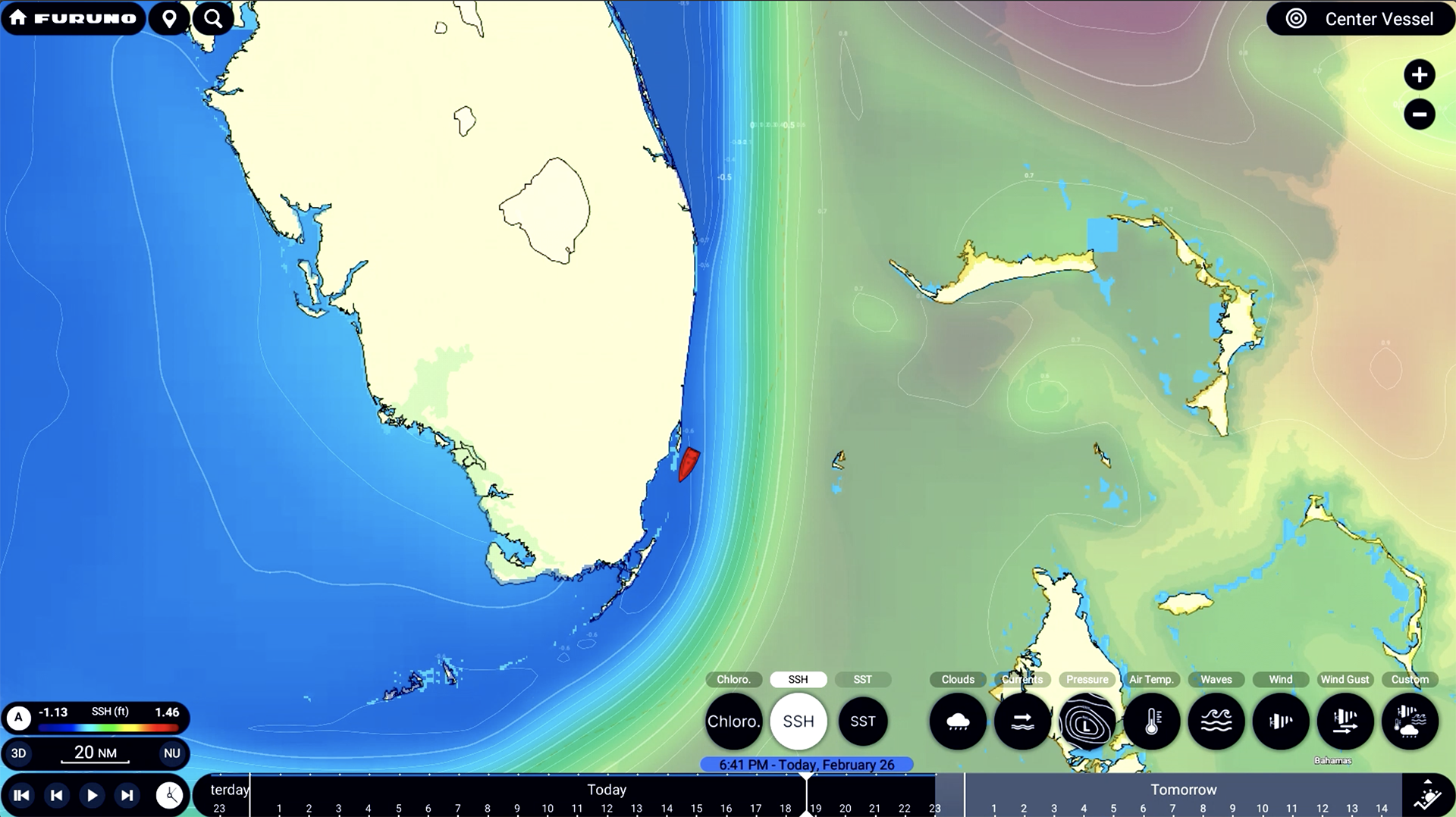
Sea Surface Height (SSH)
SSH data reveals changes in ocean surface elevation, a key indicator of currents and eddies. With TZ Weather, you can visualize these subtle shifts, ideal for offshore anglers looking to pinpoint zones of upwelling where baitfish and predators gather.
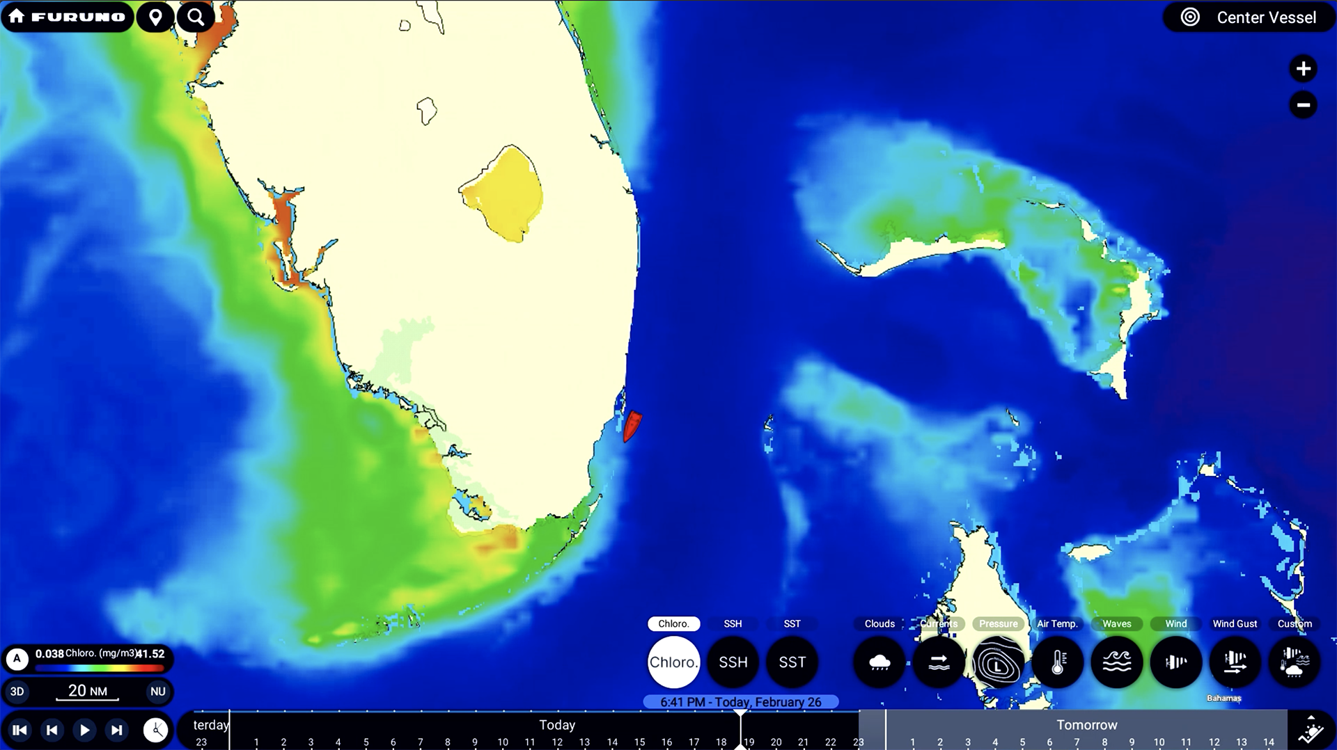
Chlorophyll Concentration
Chlorophyll overlays help identify nutrient-rich areas of the ocean, often correlating with zones of high biological activity. Use this layer to locate productive fishing grounds, as chlorophyll concentrations can indicate where baitfish - and big game - are likely to be found.
Wind and Wind Gusts
Wind direction and speed are central to voyage planning. TZ Weather provides reliable wind forecasts with high-resolution detail, so you can avoid headwinds, take advantage of favorable conditions, and ensure a smooth, fuel-efficient journey.
Wind gust overlays help you prepare for sudden and temporary increases in wind speed, which can impact vessel handling and safety. TZ Weather offers gust data with excellent resolution and accuracy, giving you a clearer picture of short-term wind dynamics.
Wave Height & Direction
Stay ahead of sea conditions with TZ Weather’s wave forecasts, which show both wave height and direction. Whether you're planning a crossing or anchoring overnight, this layer helps you find the smoothest ride and safest anchorage.
Air Temperature
TZ Weather also provides accurate air temperature forecasts to help with comfort planning and environmental monitoring. Whether you're trying to beat the heat or prep for cooler conditions, this layer lets you anticipate changes in onboard conditions.
Air Pressure
Barometric pressure is a critical indicator of weather trends. With TZ Weather, you can visualize pressure systems moving through your area, making it easier to spot developing weather fronts and plan around potential storms.
Currents
TZ Weather’s current overlay displays ocean currents in real time, helping you optimize navigation routes, reduce fuel consumption, and better understand how water movement may impact your position or drift.
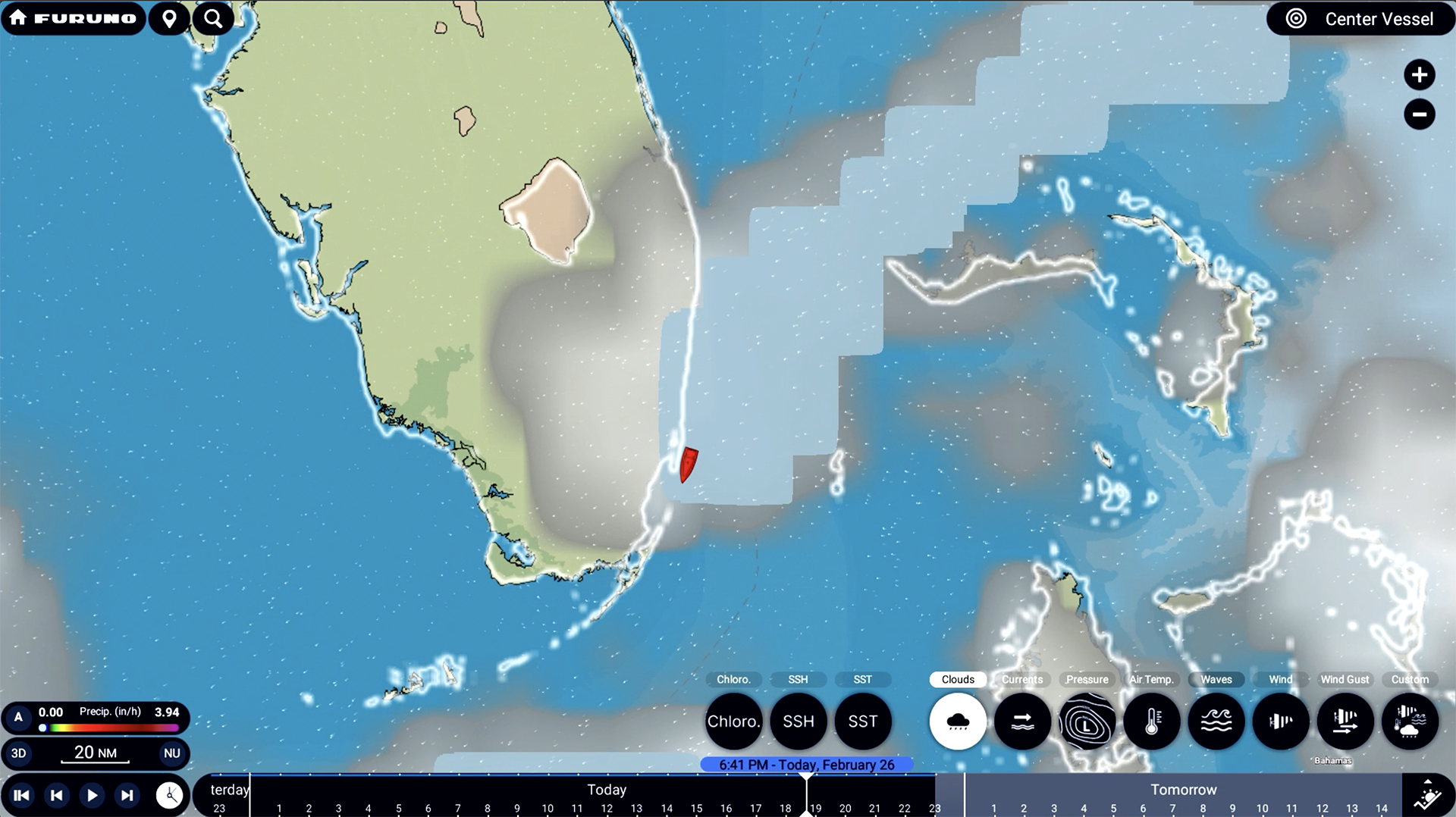
Cloud Cover
Cloud overlays help you monitor sky conditions and anticipate changes in visibility, sunlight, or the likelihood of precipitation. Whether you're navigating visually or planning for solar charging, this layer provides valuable context.
Get even more with a Premium subscription
With a Premium subscription of $8.99 USD per month, you can transform TZ Weather from a basic forecasting tool into a full-featured, high-precision marine weather system, ideal for serious cruisers, offshore anglers, and anyone who wants to make the most informed decisions at sea.
Premium unlocks advanced global and local models with dramatically improved resolution:
ICON Global – 6 km resolution worldwide (vs. GFS at 25 km)
ICON Europe – 6 km resolution
NAM CONUS – 3 km resolution (for North America)
Arome – 1 km resolution (for French coasts & nearby regions)
Arpege – 10 km resolution (Europe-wide)
These models offer much finer detail and more accurate short-term forecasts.
A Premium TZ Weather subscription also unlocks advanced wave models with resolution down to 3km, more granular SST, SSH, and Currents data, as well as higher resolution data for nearly every other parameter.
I'm ready to learn more!
Fill out the form and let us keep you informed of emerging fishing technologies as they're introduced, share our library of reference material, and show you the best way to contact your local Furuno dealer.