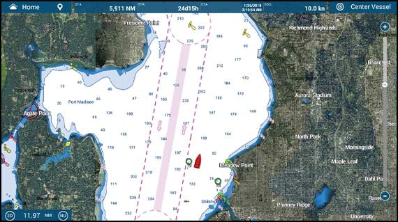
SATELLITE PHOTOFUSION™
Satellite photography is included in most MapMedia charts and accessed using PhotoFusion™. Land areas (zero depth) are completely opaque, displayed as satellite photos on the chart. As the depth increases, the satellite image is merged with the chart data to provide you with added detail on seabed areas in shallow water without losing vital chart information.
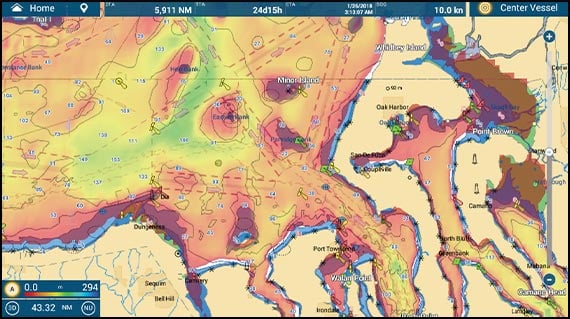
DEPTH SHADING
A depth color scale can be applied to both 2D and 3D vector and raster charts. Transparency levels can be adjusted, so that chart data is visible beneath the color shading. This feature allows you to view water depths at-a-glance with vibrant colors. No more searching for depth numbers, when you can easily set depths to your specified colors
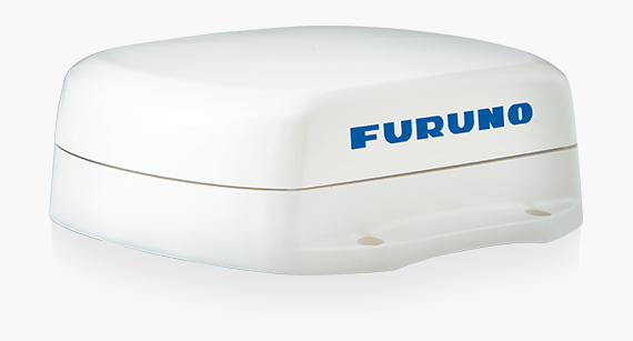
MODEL: SCX-20 Satellite Compass™
The SCX-20 enhances the performance of onboard NavNet TZtouch3 sensors such as Radar, Fish Finders, Sonar, and Autopilot. The unprecedented quad antenna design of the SCX-20 makes it capable of calculating extremely accurate heading, pitch, roll, and heave information.
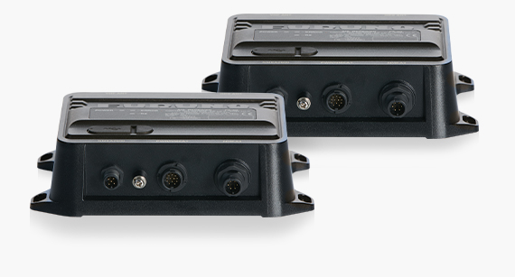
MODEL: FA-40 and MODEL: FA-70 AIS
The FA-40/70 AIS receives the vessel name, call, sign, position, COG, SOG, and other useful information from surrounding vessels. The FA-70 is a class-B+ AIS that transmits to your vessel information at higher power and faster rates than typical class B units for added awareness. SOTDMA guarantees an AIS time slot allocation, making you visible in congested waters.
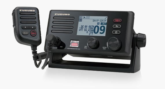
MODEL: FM-4800/4850 VHF/DSC/GPS/AIS/hailer
The FM-4800/4850 is a marine VHF Radiotelephone with built-in Class D DSC, GPS Receiver, AIS Receiver, and Simplified Loud Hailer with intercom. Its built-in AIS Receiver can be used to overlay AIS targets on your NavNet TZtouch3, and the GPS receiver can be used for a backup.
MARINE WEATHER FORECASTING
The weather tool is completely free & easy to use, giving you unlimited access to Navcenter worldwide weather forecasts, 24 hours a day. Select the coverage you want, the type of data you need, and for what time period, then simply download the data.
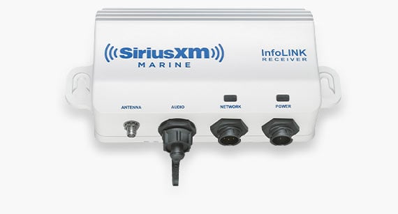
Also available on NavNet TZtouch3 is the BBWX4 SiriusXM Satellite Weather Receiver. Get up-to-date weather info/forecasting, and play your favorite SiriusXM Satellite Radio channels. (US & Canada only)

Because finding your HAPPY PLACE shouldn't be difficult.
Learn about the User Interface

We're pushing FISHING TECHNOLOGY to its limits and it feels good.
Learn more about TZtouch3 for Fishing

Welcome to your GO ANYWHERE command center.
Learn about the Cloud & Apps

More power means BETTER DETECTION of all the targets around you.
Learn about Radar for TZtouch3